Masterprojekt SoSe22
What happened here
Goal
Oftentimes, people walk past places with distinctive histories without even realizing. With our project we want to provide users with access to information about important cultural, historical and social events and connect this information to places around them. The location based notifications are designed to make it as simple as possible for the users to engage with these topics in their day-to-day lives. They can also share newly found information with other people and personalize their area and topics of interest.
The editor is designed for institutions that want to share information and draw attention to different topics. They can manage their places and assets while categorizing them, so that users can easily find them.
The app currently only offers data about places in Berlin, but this is not a limitation. Users are able to select between English and German, which opens up the possibility to add other languages in the future.
App
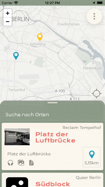
Home screen
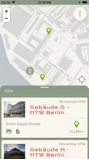
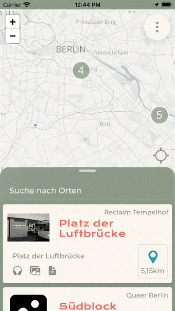
One of the core features of the App is the map where users can see their position and all the available points of interest (POI) are indicated with markers. The markers are shown in different colors acoording to the category of the POI. Categories are used to group POI by similar histories. Clicking on a marker will navigate to the detail view of that POI.
Underneath the Map is a modal with a list of all the available POI. For each place it shows the name, address, distance and available media. If users are searching for a particular place they can use the search input to find it. Selecting a place also opens the detail view.
Detailed information about a place
The detail view of a POI shows all the available information and media about the place. At the top it shows the name, an image, the address and the address description. Below that is a text description, audio and a gallery of all the images if alvailable. At the top users can save their favourite places by marking them with a star. They can also share places with friends via the native share feature.
Notifications based on Geolocation
While the app is running in the background it accesses the location of the user to send a local notification to them when they are close to a POI. Clicking the notification will open the app and show the detail view of that POI. The app will only send one notification per POI in a session.
In Android the app will show a notification for the whole time it is running in the background. In iOS the geolocation access is indicated while the app is running in the foreground and background.
Filtering
Via the menu button on the Home screen users can filter POI. They can be filtered by radius around the current position of the user and by categories. In the Filter screen users can also choose to only show the POI they marked as favourites.
Editor
Home screen with filtering of POI
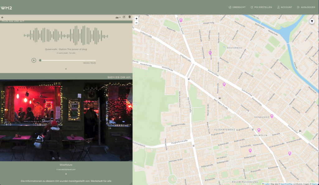
The home screen of the Editor shows the map with the pinned locations on the right side, and an overview of all the POI on the left side. The small icons in the card of each point indicate what kind of content is stored. The markers are colored based on the category of the content and the filter option lets users choose which categories they want to look at. Specific points can be found by narrowing down the shown categories or by simply using the search function. As this view is for the content managers, it functions as an overview of the distribution of the POI, and a preview of the content for each point. From here, they can also navigate to creating and adding new points.
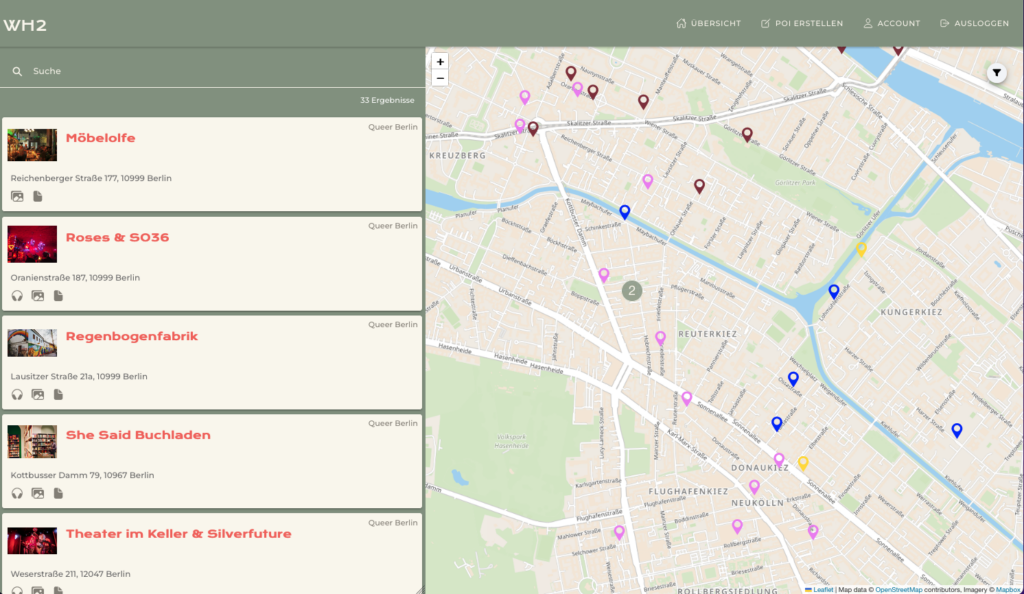
Create POI by category
Each editor can create categories with a specific color in which they later can assign POI to (e.g Queerwalk, forced labor in Berlin, etc). The POI contain an address, an address description, a description and assets (for now audio and images). The address can be typed in or set by clicking on a location on the map.
Interactive Map
The map and the list of POI are connected seamlessly. Selecting a specific point from the list of POI on the left navigates to it’s detailed preview of the content, whilst the map centers around this point by flying to it with a little animation. The same happens when a marker on the map is clicked.
Also, when creating a POI, it is possible to provide the coordinates by clicking on the map. This helps with POI which are located on a special place which cannot be expressed by an address.
POI detail preview
The detail view of a POI serves as a preview to what the users will see when coming across this point. This serves editors to double-check the content they have added and try it out themselves. From here they can also edit the point and make any changes to the general information of the content, as they please. It includes the main picture selected for the point, the detailed address and an address description in case needed. The rest of the detail view is dynamically built, depending on the content types that are available.
Multi-language support
Our WH2 Editor provides the possibility to not only to be used in multiple languages but further more also allows the editors to create POI, categories and their assets in those. Currently, we support English and German.
Partners
Since our goal is to fill our app with interesting subjects from different institution, we reached out to potential cooperation partners parallel to the development of our apps. Thank you at this point for your help, support and informative POI!
“werk stadt – für alle”, a project self-managed by students at the TU Berlin. They cover three topics “Queer Berlin”, “BIPoC Berlin” and “FLINTA”.
“RECLAIM TEMPELHOF!”, agency for performative formats with an urban and socio-political focus in and about public space.
Team
- Paula Osterkamp
- Luis Hankel
- Emily Gilbert
- Mahja Sarschar
Betreuung
Alexander Kramer
Links
https://showtime.f4.htw-berlin.de/ss22/master/m3-geolocation